
After hiking the PCT in 1996 I waited twenty years before I could begin a thru-hike on the CDT. Family obligations, a mortgage and an interesting but tumultuous career limited my hiking on the long trails to occasional section hikes. Getting laid off from my job of eleven years relieved me of the stresses or a corporate career. After I announced to my Facebook friends I would attempt the CDT in 2016 I received an invitation from Whitney “Allgood” Laruffa to join a group he named the “Portland Mafia,” a collection of our friends who planned to hike the CDT. I knew nothing about hiking in New Mexico, and attending CDT Trail Days in Silver City before starting the hike was an introductory course for hiking the state. The old mining town has a rich history and robust revival as an arts community, and I looking forward to hiking into town soon after embarking from the border with Mexico on April 18.
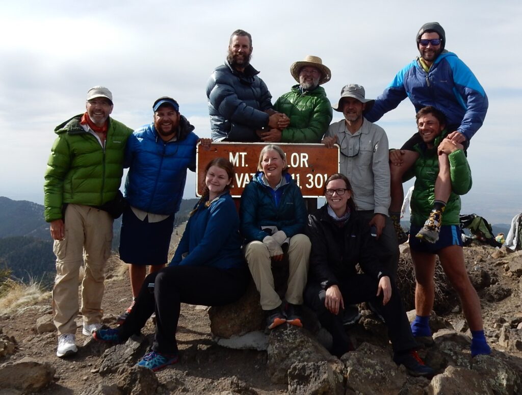
The “Portland Mafia” and friends on Mt. Taylor, New Mexico, May 14, 2016 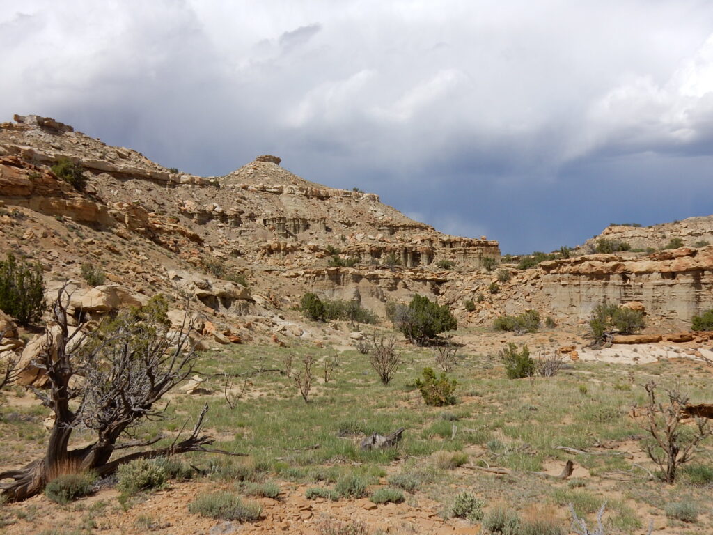
Mesa Portales, New Mexico, May 16, 2016 
Mesa Portales, New Mexico, May 16, 2016 
With Moni (Cheezy) and Emma having south of Chama, New Mexico, May 26, 2016 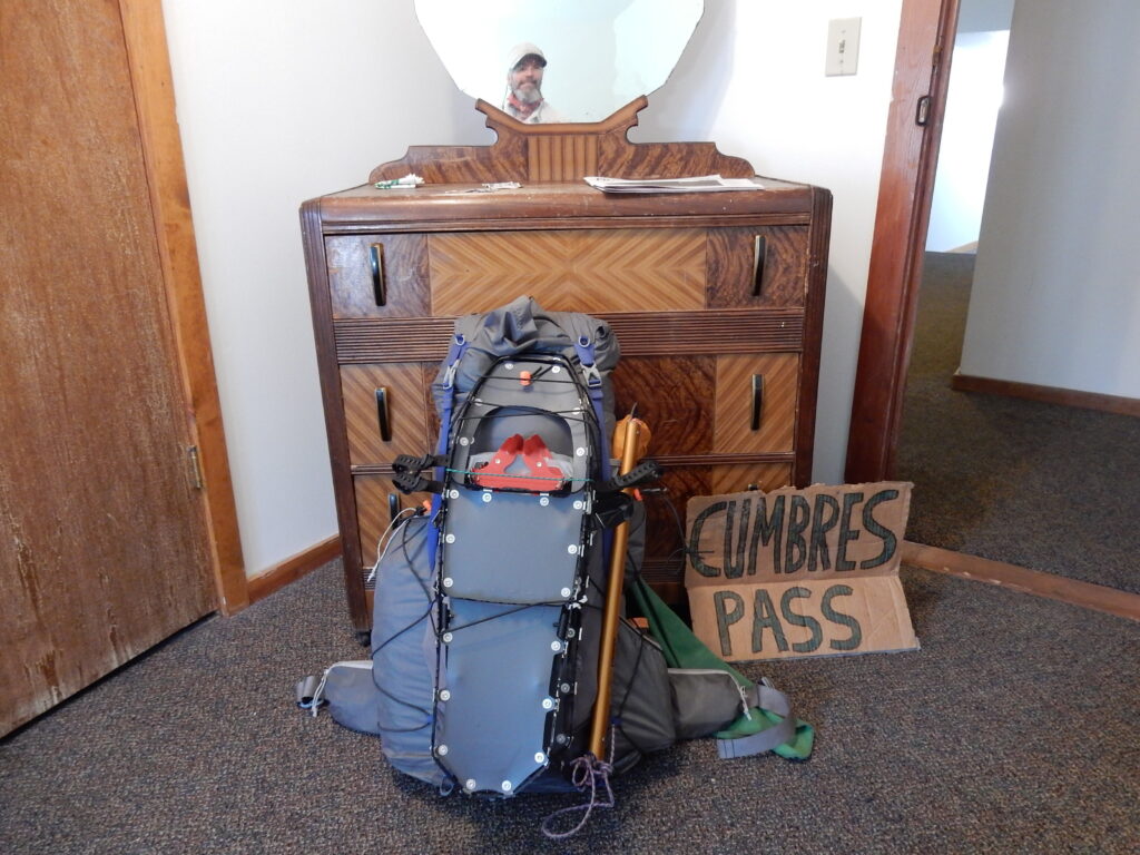
Packed and ready to head into the South San Juan Mountains, June 3, 2016 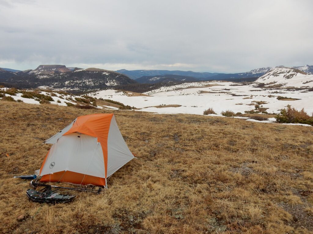
South San Juan Mountains, Colorado 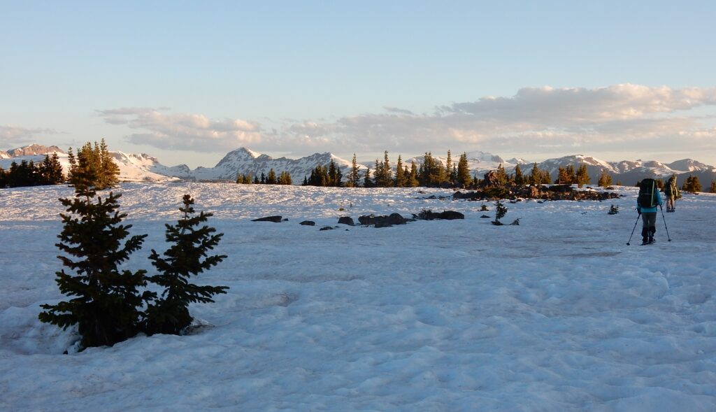
South San Juan Wilderness, June 5, 2016 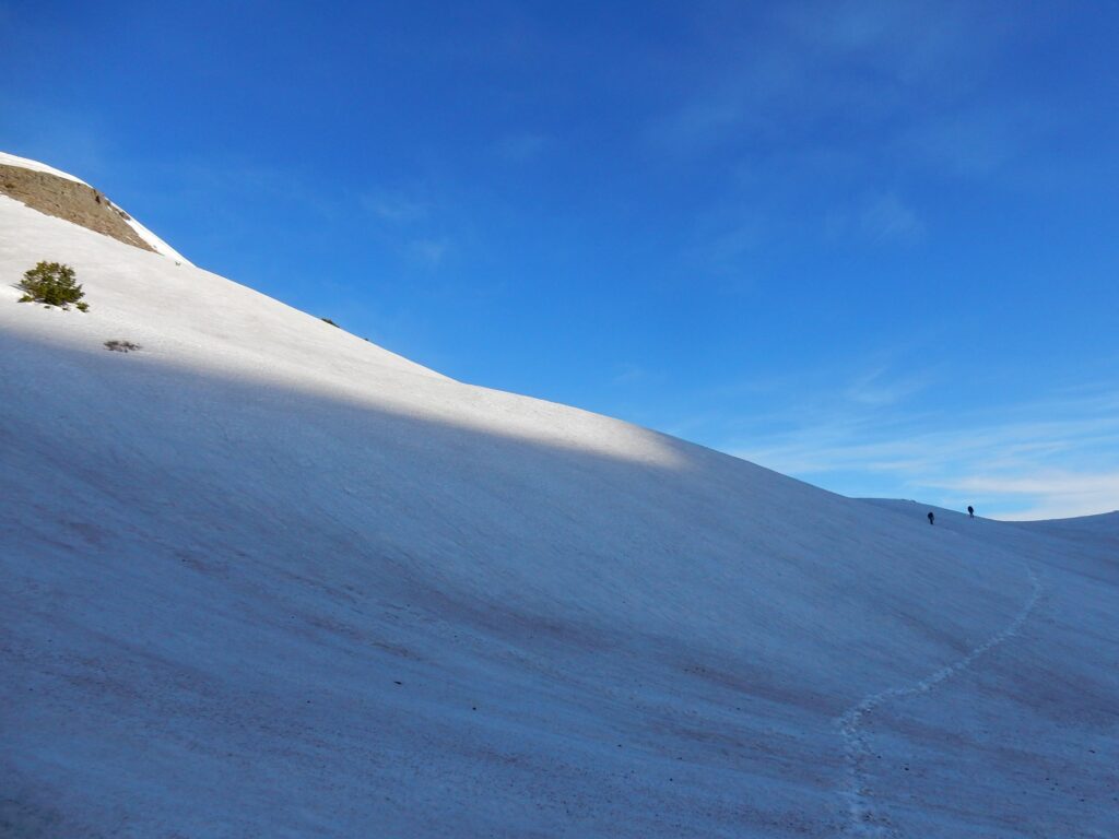
Traversing in the South San Juan Mountains, Colorado 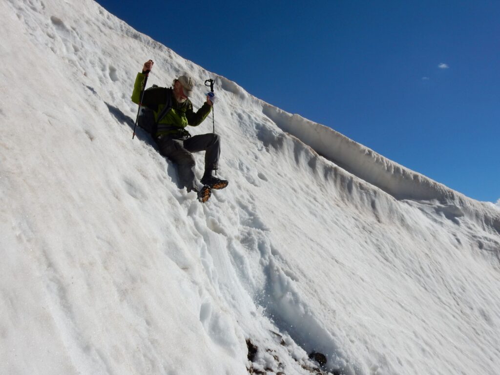
CDT hiker Elusive takes a precision slide at Lake Ann Pass, Colorado 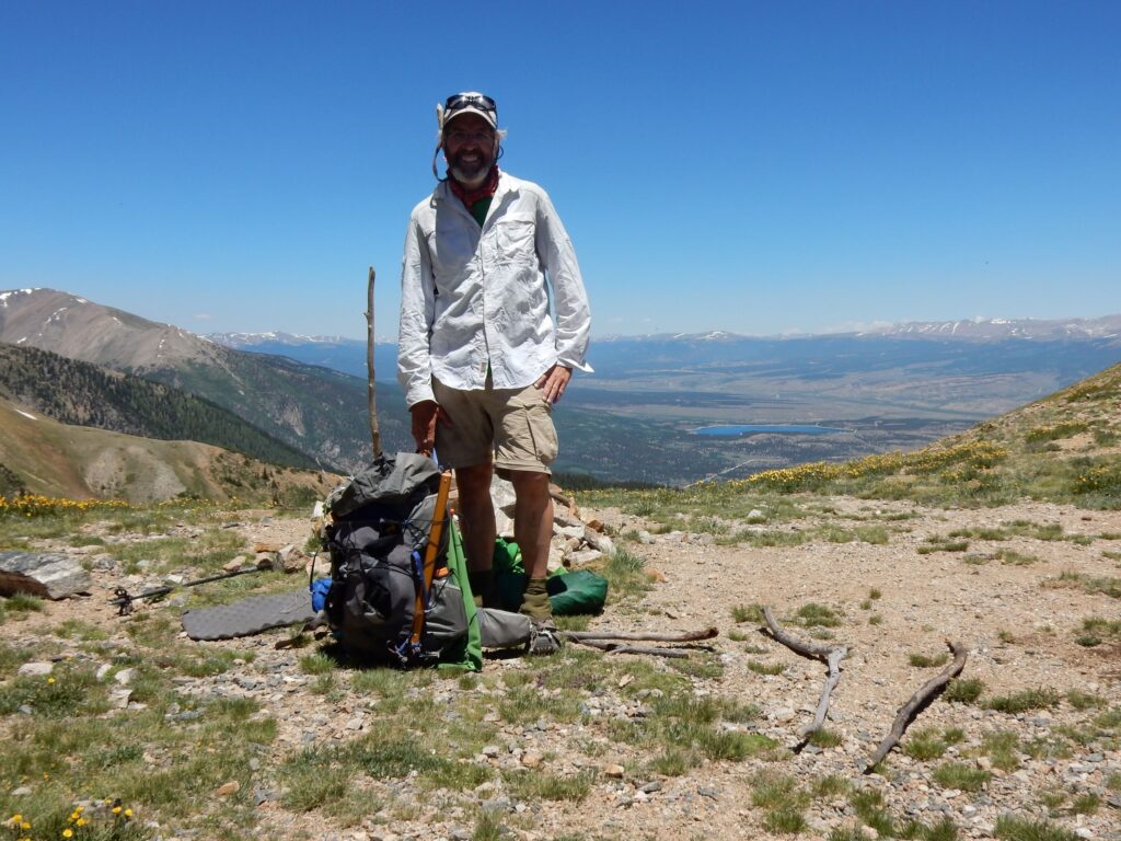
Hope Pass, south of Twin Lakes, Colorado, June 27, 2016 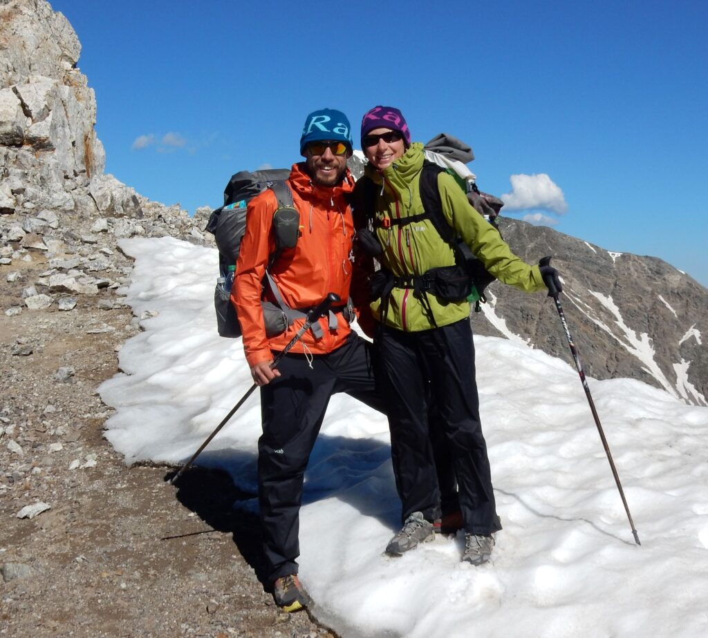
Footprint and Stormrunner near 14,270′ Gray Peak, Colorado on July 6, 2016 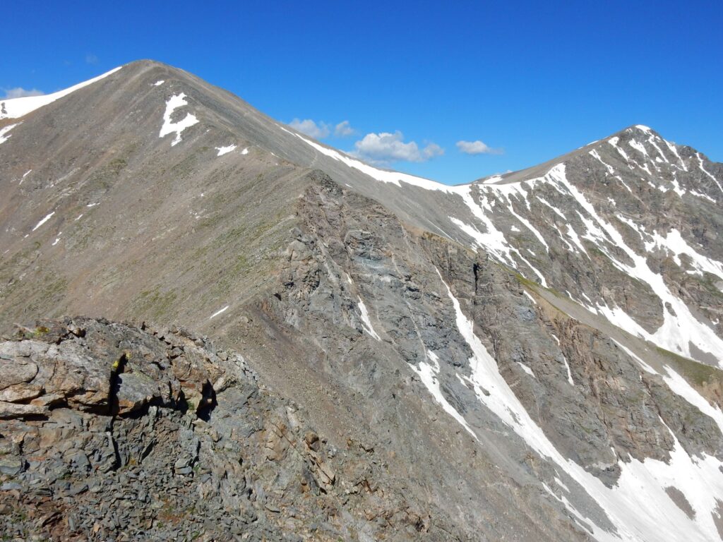
Grays Peak (left) is on the official route of the CDT, July 6, 2016. 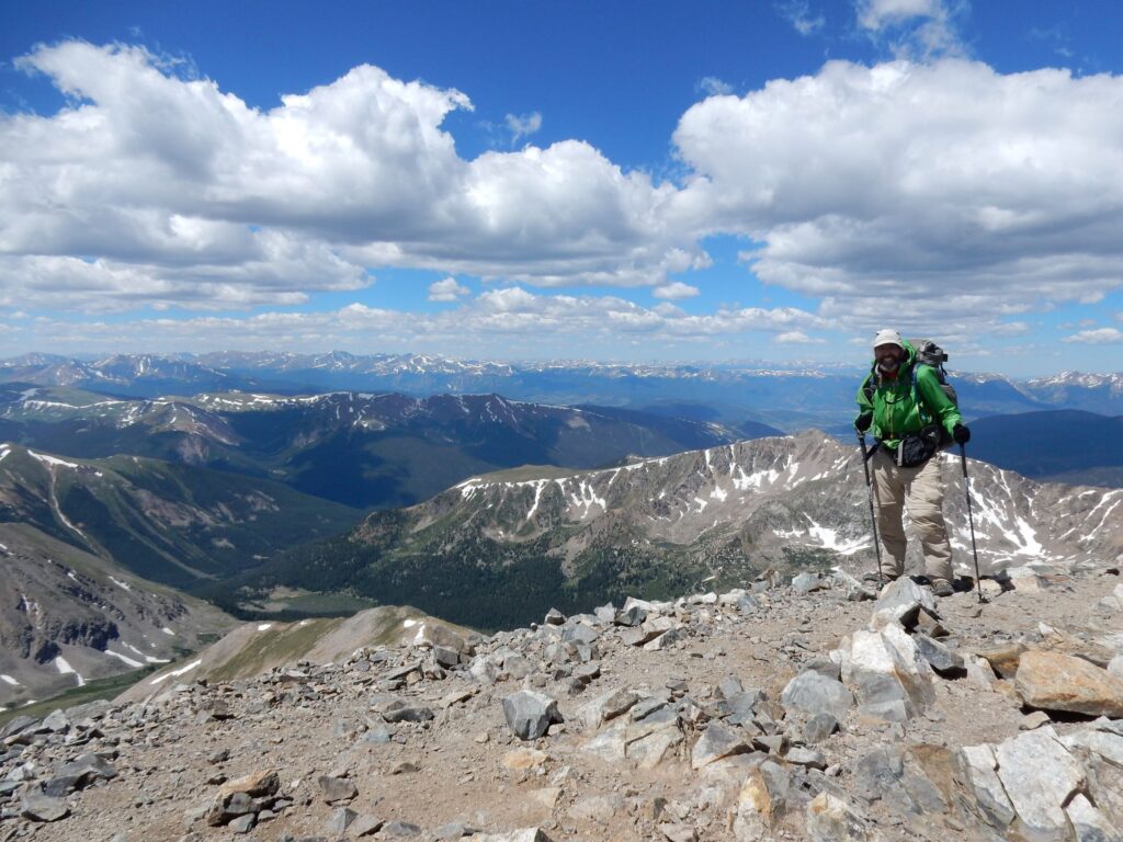
On the summit of Grays Peak (14,270′) on July 6, 2016 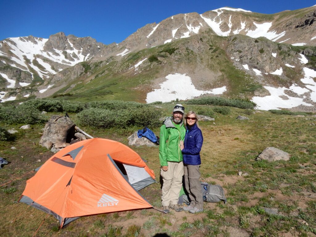
Cindy and I celebrated our wedding anniversary on the CDT next to Herman Lake, Colorado, July 6, 2016 
On the Rocky Mountain N.P loop, July 15, 2016 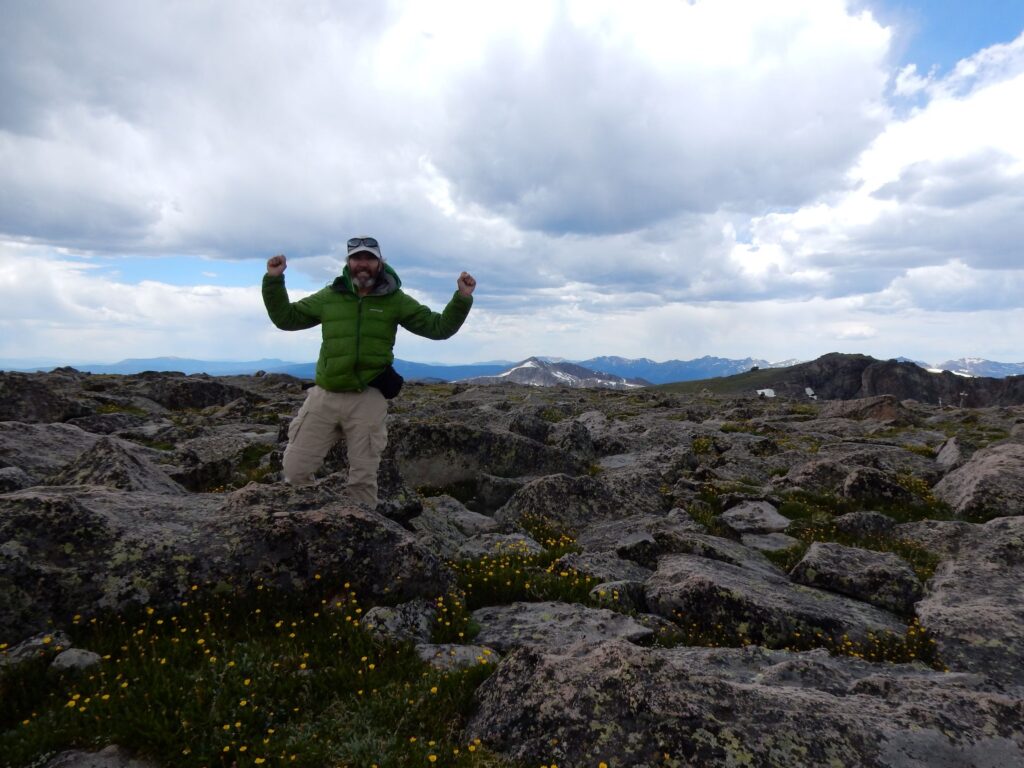
On the summit of Flattop Mountain (12,329′) in Rocky Mountain National Park, the place of my first wilderness hike in 1977. 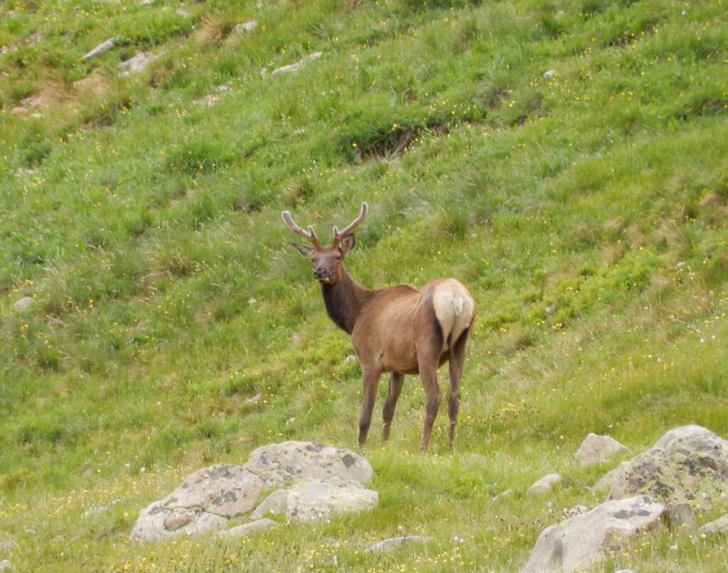
Elk along the Rocky Mountain N.P. loop, July 15, 2016 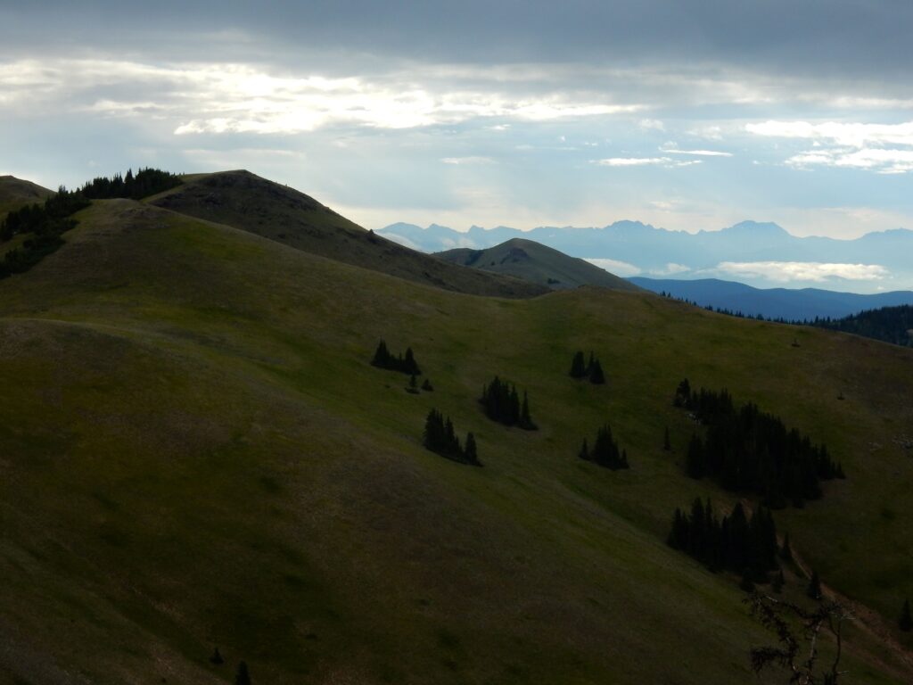
View from Sheep Mountain (11,825′) back towards Rocky Mountain N.P., July 19, 2016 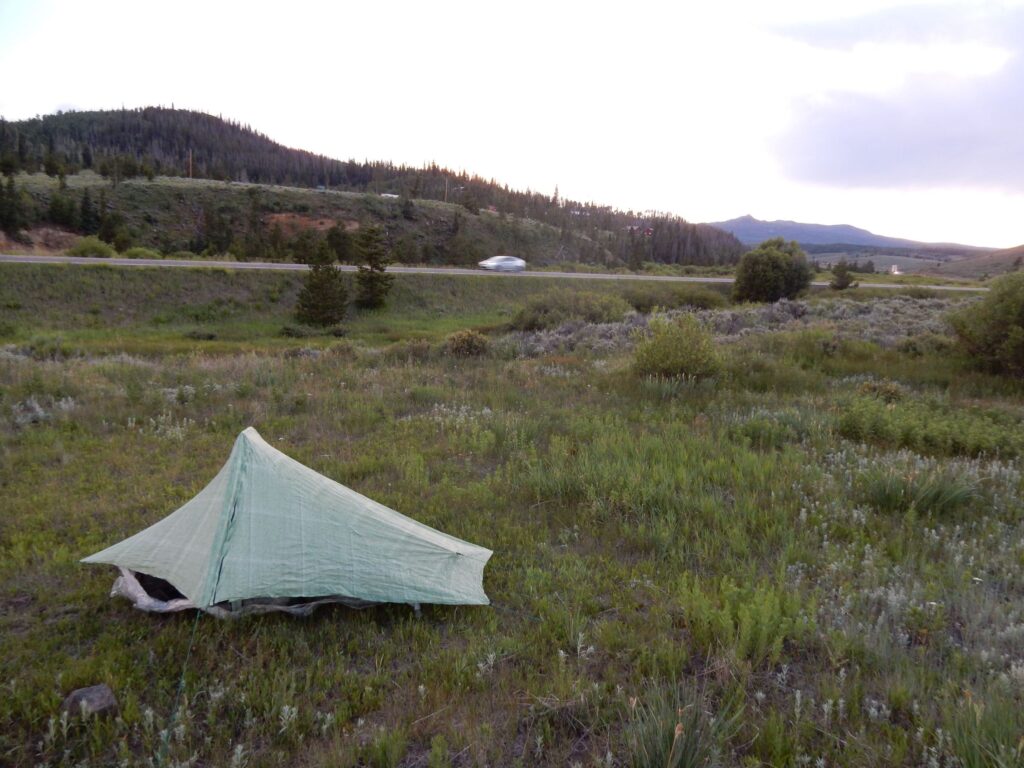
Not a great camp, along Hwy 14 south of Steamboat Springs, Colorado, July 19, 2016 
Encampment, Wyoming for a short, unplanned stop to rest the injured knee on July 26, 2016 
Great Divide Basin, Wyoming 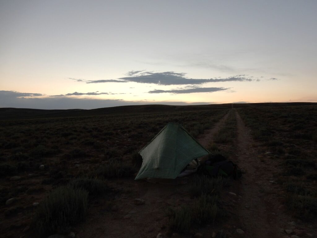
Camping on the jeep track in the Great Divide Basin, Wyoming on July 31, 2016 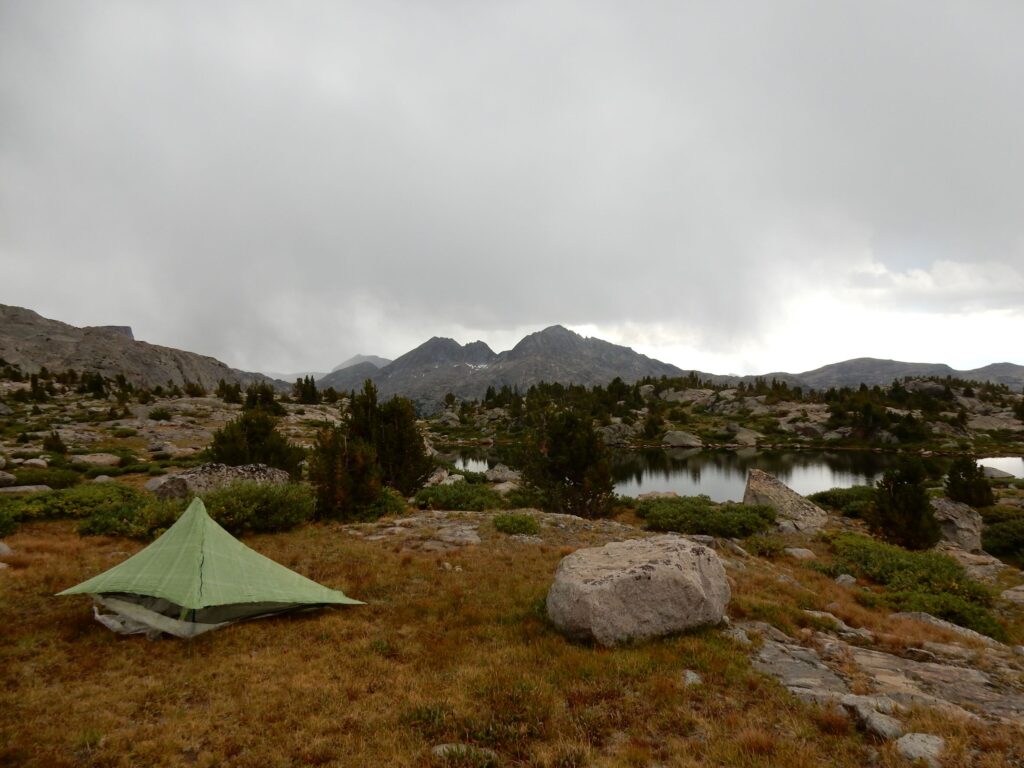
Wind River Range, Wyoming as the thunderstorm approached, August 11, 2016 
Ascending from the Green River area to Gunsight Pass, Wyoming, August 13, 2016 
Sheridan Pass, Wyoming, August 14, 2016 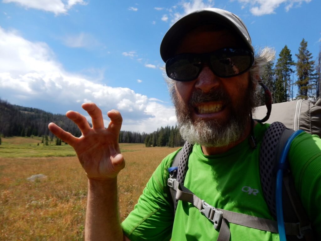
Teton Wilderness, Wyoming in the heart of grizzly bear country, August 17, 2016 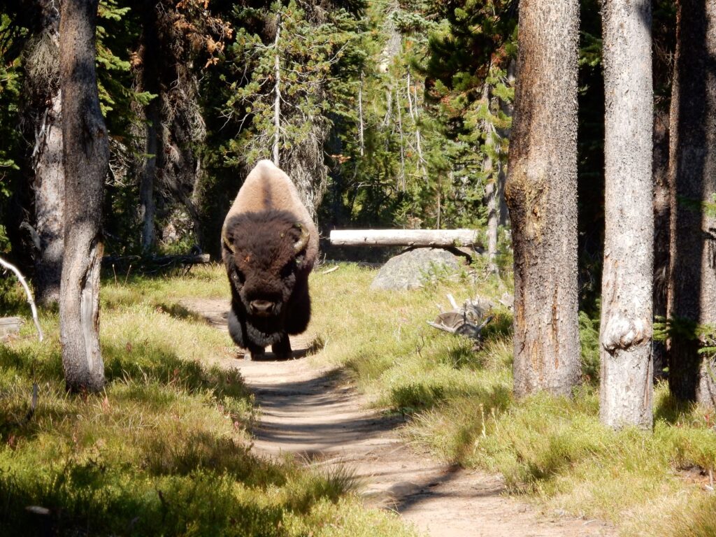
Bison approaching on the trail in Yellowstone National Park, August 22, 2016 
Bannack Pass, Montana where the CDT crosses South Medicine Lodge Road on August 31, 2016 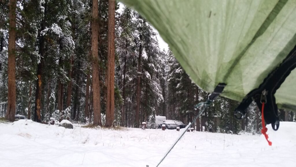
Several inches of snow at the Mono Creek Campground in the Pioneer Mountains, September 5, 2016 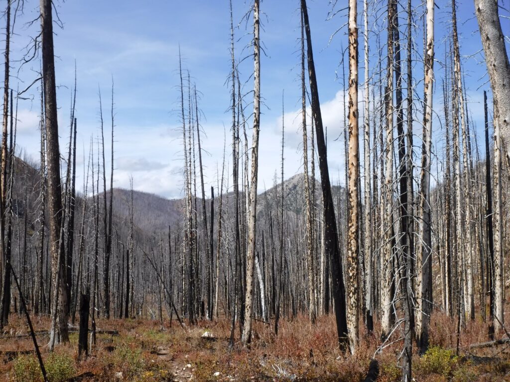
A burned area in Scapegoat Wilderness, Montana, September 19, 2016 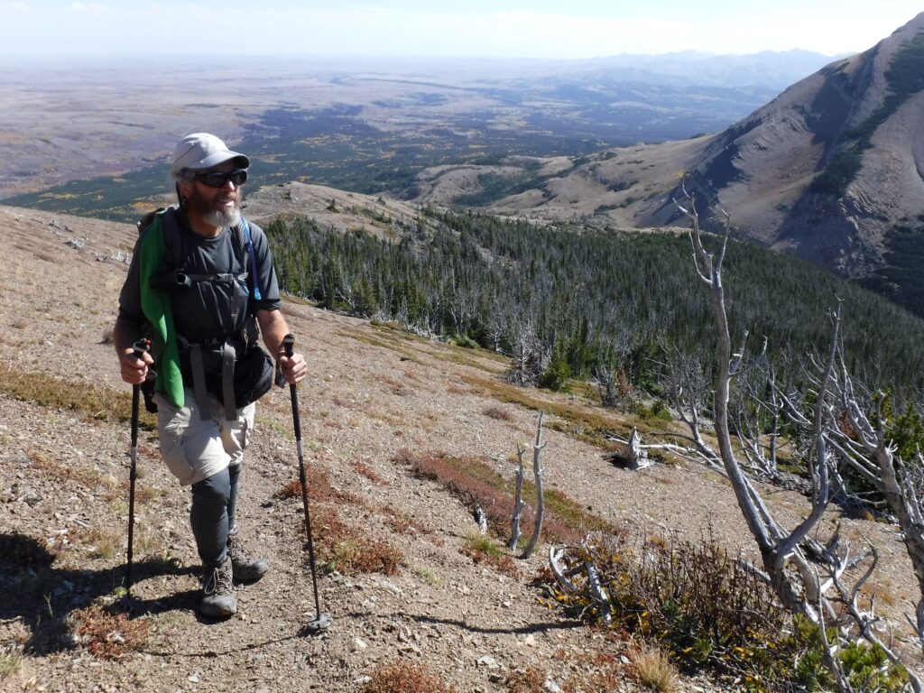
Ascending from East Glacier in Glacier N.P., September 28, 2016 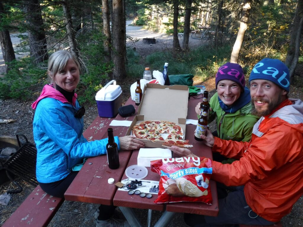
Cindy, Stormrunner and Footprint at the Two Medicine Campground in Glacier N.P., September 28, 2016 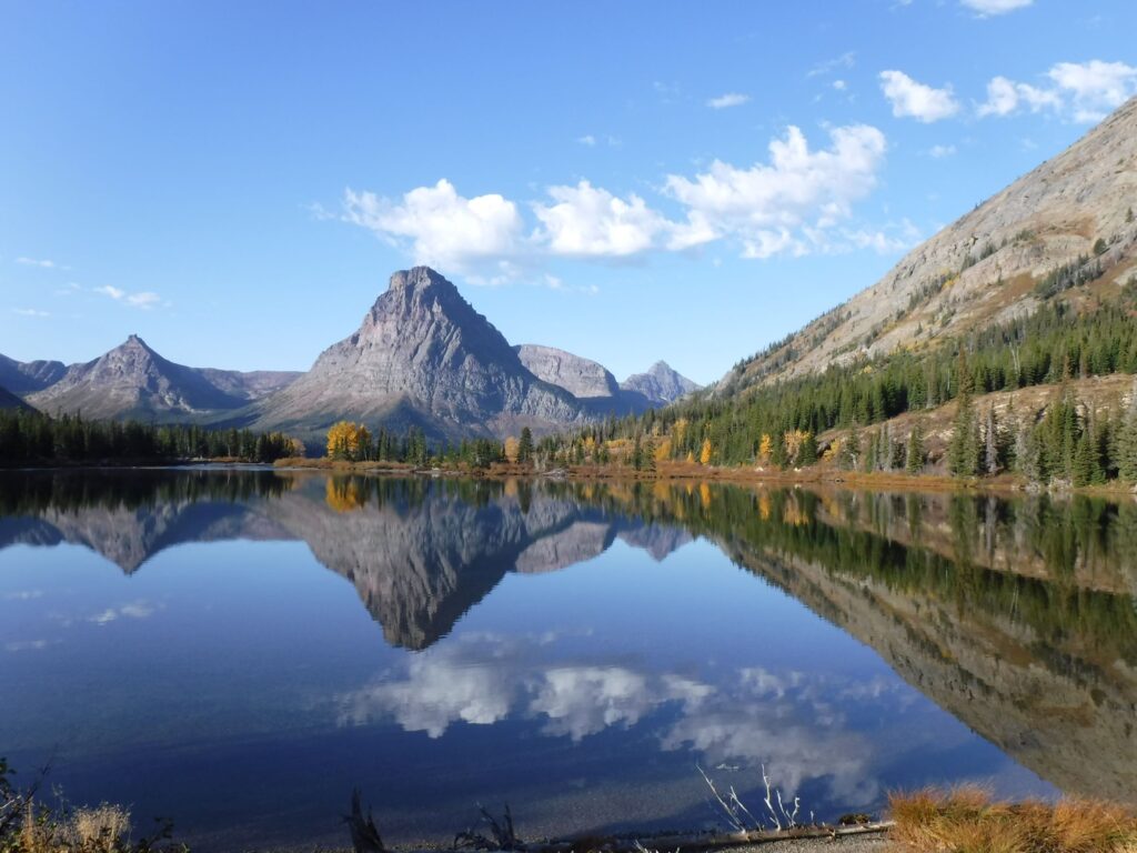
Iconic view of Two Medicine Lake, Glacier N.P., September 29, 2016 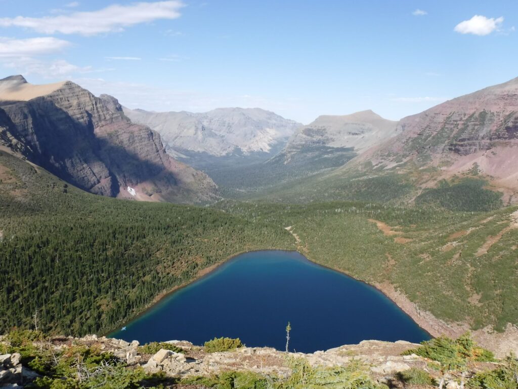
Pitamakan Lake and the Cut Bank Creek valley as viewed from Pitamaken Pass, Glacier N.P., September 29, 2016 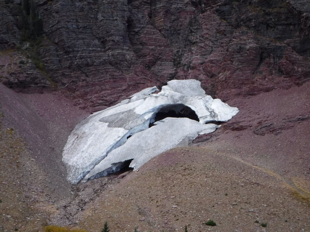
A disappearing glacier above Morning Star Lake, Glacier N.P., September 29, 2016 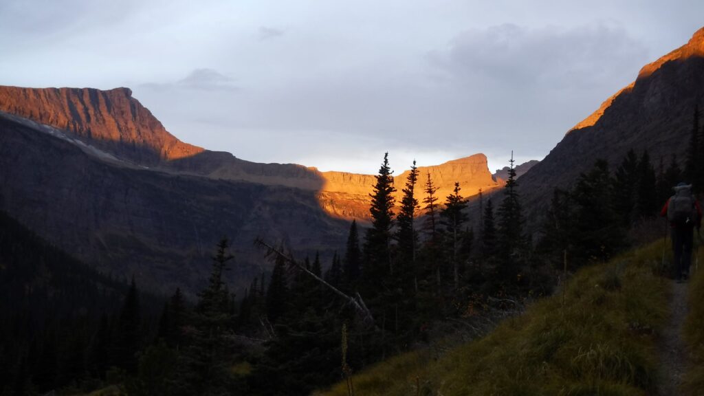
Approaching Triple Divide Pass in the early morning of September 30, 2016 
Approaching Triple Divide Pass, Glacier N.P., September 30, 2016 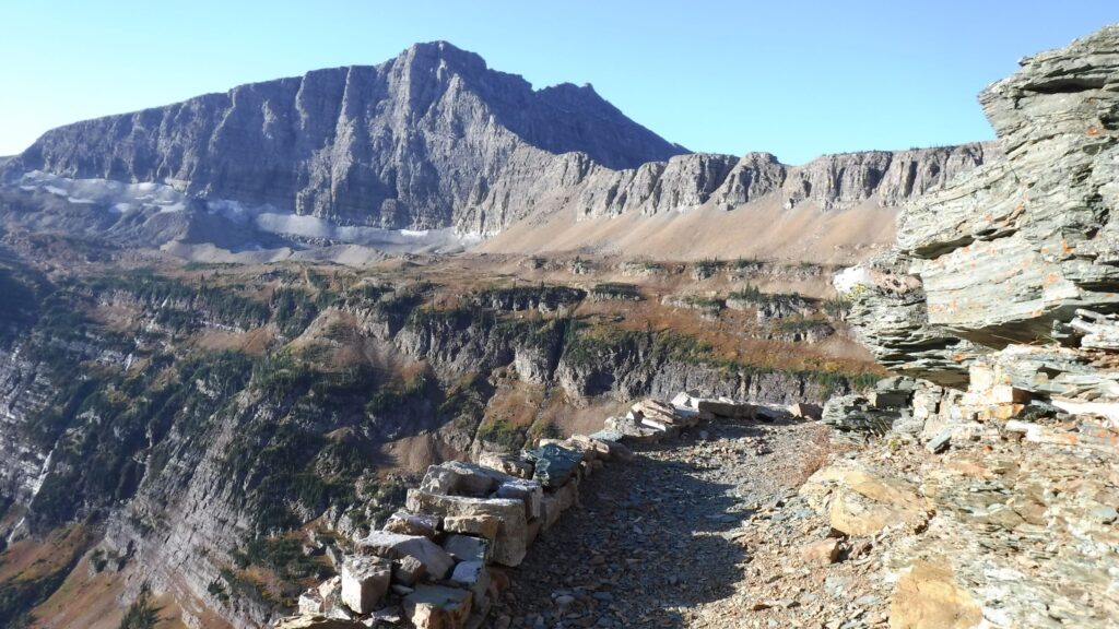
Approaching Triple Divide Pass, Glacier N.P., September 30, 2016 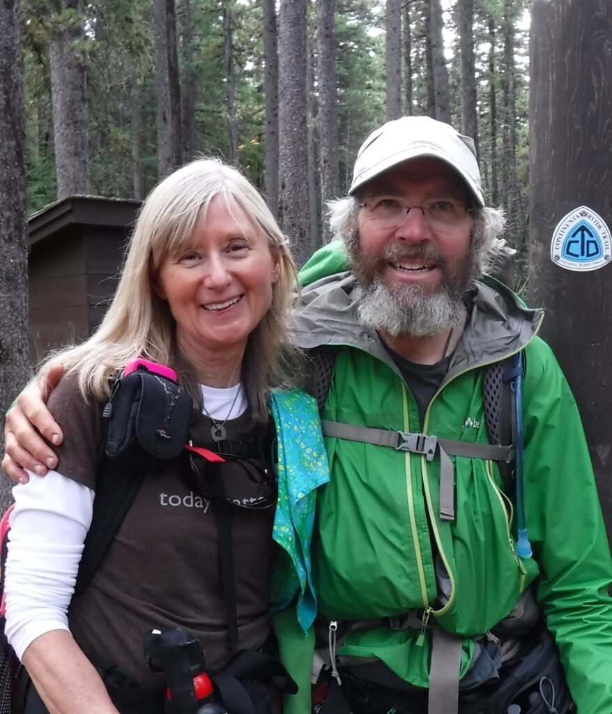
With Cindy just steps from Canada, October 3, 2016
Trouble happened even before I took step one on Day 1. After showering in the motel room in Lordsburg, I screamed fearfully after jamming a toe into the bathroom door. Despite the pain, and convinced that the toe was not fractured, I climbed in the vehicle driven by Tereasa Martinez, the Executive Director of the CDT Coalition, rode the bumpy gravel roads to the Mexican border, and soon took my first-ever steps on a hiking trail in New Mexico on April 18.
It is common to “roll your own route” in some places on the CDT. I chose the Gila River route on April 27 where the route through the magnificently colored canyon required at least 100 fords of the river in knee deep, gently flowing water. I had plenty of company along the way.
The “Portland Mafia” grew with an international flair to include Allgood, Freefall, Big John, Sweet Potato, Moni (Cheezy) from Germany, Emma from England, Peg Leg, Buttercup from Germany, Zoro from Spain, and Bandit. Most were on the summit of Mt. Taylor (11,301 feet) on May 14 when I huffed it the summit, predictably the last hiker to arrive. The Warrior Hikers, who served in the recent Middle East wars, were well represented. The number of thru-hikers on the CDT in 2016 was at least 250. Twenty years before a CDT hiker in 1996 might not ever see another thru-hiker! Times had changed for the better, I believed. Being around friends as I hiked through 657 miles in New Mexico greatly enhanced my time there.
Carol and Hugo Mumm in Grants were water angels with their cache at the entrance to the parched El Malpais area and trail angels in town. Six days later, inside a grocery store in Cuba, New Mexico, an elderly woman asked, “are you one of the CDT hikers?” After explaining my intention to hike all the way to Canada, she graciously said, “I am a little like you. I don’t drive a car and walk everywhere I need to go. It’s how I choose to live here. May I pray for you?” I smiled to the kind woman saying, “thank you, and yes you may!”
Her kindness was prophetic. On May 26 after 657 punishing miles of hard, rocky trail with my feet occasionally pressing through snowfields and dunked in water, I felt a shooting pain running up from the injured toe and into the foot. On the first zero day in Chama, New Mexico I was concerned enough to ride the free bus to Espanola, where a doctor concluded the toe was infected. She prescribed an antibiotic but urged me to rest the foot for at least five days. I stayed in Chama at the Fosters Hotel while my friends climbed onto the scenic steam-engine train to Cumbres Pass and hike into the snowbound South San Juans. On June 3 I joined a French couple Paul and Chantal, and later joined by Freebird for the breathtaking, snowy traverse across the ridges in the South San Juan mountains. In Colorado, north of Wolf Creek Pass I chose to hike the much shorter Creede Cutoff because of the dicey snow conditions on the official route, and to make up for the week off the trail.
But the snow was melting fast. While listening to a Colorado Public Radio program I learned that ranchers and farmers in the state were making critical changes in the management of their lands because of the changing climate. Trees, dead or dying from bark beetles, were another signal of how the warming of the western states was beginning to affect the mountains, and especially along the CDT in Colorado. As I approached Monarch Pass on June 19 the large snowfields had nearly melted out completely except for a few large patches.
Between Monarch Pass and Twin Lakes, Colorado I joined thru-hiker Elusive, who is in the photo making the nearly vertical slide off of Lake Ann Pass. For both of us, with similar ages, hiking at high elevation had unique challenges. On July 6, while on the steady approach to 14,000-foot Grays Peak, I was accompanied by a very nice couple from Czech Republic, Footprint and Stormrunner. That high the lower oxygen in the can lead to various problems, and I am grateful for Footprint, a skilled mountaineer, for keeping me from doing anything stupid and leading the way to the final approach of snow-free Grays.
But the hazards of the CDT are present at much lower elevation, too. A couple of days earlier, just outside of Breckenridge, Colorado, I took a hard fall on the trail while avoiding the speeding mountain bikes that had access to the trail. The excruciating pain in my left knee felt like it could have ended my journey. The pain subsided, and did not affect me days later on the 6,055 foot ascent and 19 mile hike over Grays Peak to a surprise wedding anniversary meeting with my lovely wife Cindy at Herman Lake. Everything changed on July 18. As I descended the steep north side of Park View Mountain the intense paid in the knee returned. The injury was serious enough to make me wonder how I would hike over 1,000 more miles in such pain. The CDT began to wear on me. Upset at every PUD (pointless up and down), I sometimes cursed at the trail. In the Mt. Zirkel Wilderness, a large tract of scorched trees wildfires screamed as sharp winds blew through dead, barren branches. In Rawlins, Wyoming an orthopedist told me I might need surgery to repair the meniscus after an MRI. “Doctor,” I explained, “either I can hike to Canada or not. Only my knee has the answer. I go back to the CDT tomorrow.”
Hiking across Wyoming was a completely solo journey, limping through the Great Divide Basin and into the Wind River Range. My friends were ahead of me. On the relatively flat terrain I was able to hike 25 miles per day on a bum knee. I should have been able to get 32 miles, and 25 the rest of the way to Canada. A worrisome feeling crept inside me as I watched the simplistic rolling grasslands of the wild horse & pronghorn country pass by. My goal of reaching Canada by September 18, and before snowy weather, was unattainable.
It was hot and dry, and I soon learned of a large forest fire burning along the CDT near Togwotee Pass. An alternate route to avoid the closure area was south and lower than the official route. But after hearing of a very scary encounter with a grizzly by hiker Zoro, the alternate had no appeal. Instead, I took a more direct route from Sheraton Pass to the highway that led to the trail town of Dubois. The fire along my new route was out and the crews left the area. Carefully, I hiked on blackened soil while inhaling the ashen smell of newly burned and dead trees. That fire burned hot and fast, sterilizing the soil as it evaporated the living forest into deadly smoke. No wildlife, including grizzlies, were to be found in what was the largest on-trail fire I encountered in twenty years.
Just one day later I entered the green, fully alive Teton Wilderness southeast of Yellowstone National Park. I fell in love with what appeared to me to be one of the most remote places I had ever been. The next day it was a wolf print embedded on the trail that excited me. But it was the grizzly bear tracks and scat captured my attention the most. On August 18 under a cloudy sky, I proceeded west toward the setting sun, and the trail led me into a gently sloped ridge of conifer trees where I would camp. I entered the forest hoping it was a far enough from the grizzly highway I had been hiking upon all day. I hoped.
The darkening forest felt safe enough to find a campsite there. I was about to toss my gear the Six Moon Skyscape shelter when I heard a slow, repetitive cracking sound nearby. I turned to look for the possibilities ranging from deer to elk, wolf to wolverine, hiker to hunter. At first it was hard to identify. In a moment I saw the large bear slowly moving through the forest about 120 feet away. I recall what I learned about identifying grizzlies. The fur was brown, not like most black bear. I focused on the bear’s back. If the hump was there, and it was, yes, grizzly, yes! Carefully and silently, I reached to my right hip where the bear spray cannister was securely held in a black holster. I had practiced this sequence many times: pulled the safety strap, lifted the cannister out of the holster, released the safety clip, and ready to press the trigger if…a charge. You know, like the actor Robert De Niro in Taxi Driver, “you talkin’ to me?” In the moment I did not internalize a grizzly’s speed of perhaps 35 feet per second hurtling towards me if it chose. I would have three seconds to respond. The brown grizzly stopped, smelled, turned its head to look towards me! I studied the bear from 100 feet. It was old, I thought, and was moving slowly. I heard a loud, hissing sound coming from its nose or mouth as my heart raced and breath halted. My right index finger tickled the trigger of the pepper spray cannister with my life on the line if it charged. The intensity shot through my nerves and senses, head to toe. I knew, though, I was mentally prepared to do what was necessary to save my life. Thankfully, this bear did not appear aggressive in any way. What happened next is something I will never forget. The bear hissed, turned around in retreat and ambled away, and southbound. I dropped to a knee to look inconspicuous and never took my eye off the grizzly until it was clearly away…far away. In those brief moments I barely noticed the light rain. I hastily packed up the tent and got the hell out of that forest and back to the trail where I continued northbound in accelerating darkness for one mile. After settling in my tent I typed an InReach message to Cindy with a satisfying grin on face: “The excitement of my first encounter was great! Bear was not aggressive.” After clicking the send button, I smiled again. I had a real bear encounter, with a grizzly!
After the relatively tame hike through Wyoming the knee was feeling slightly better than it felt in Colorado. I took it easy for the next five days while hiking through Yellowstone and into Montana at a pace of just 15 miles per day. I was getting very concerned about arriving in Canada before the snow started falling. My goal was to finish on September 18, but it was already August 29 when I departed Lima, Montana. With 21 days to hike over 700 miles I knew I would need two more weeks to reach Canada. Pain in my left foot added to the still-bothersome knee, and the combination of one good leg and one bad made hiking the roller coaster hills west of Lima quite difficult. Feeling worn down, I fell hard on a relatively benign stretch of trail but avoided serious injury. After patching the bloody scrapes on my forearm I arrived at a shady spot next to inviting, clear-flowing Sawmill Creek to re-group. Knowing I must reach the Canadian border before the snow storms, I asked myself, “can I power through 30 miles per day? With the bad knee can I hike all day and into the night? Or, is another route possible?” This was nearly the same predicament as 1995 on the PCT in the Sierra Nevada. That time I chose to abort the hike. This time, it was a choice of routes. Sitting in a patch of shade, the calming sound of the creek flowing across the trail helped me think clearly. It was a pivot point and a time to think outside the box. If I chose the official route, it is possible or even likely snowstorms would prevent completing the thru-hike. A shorter route would take me off the official route, but at least I could finish by reaching Canada. Using my GPS unit and a Montana road map I crafted a route to Anaconda that looked like it followed the Great Divide route used by cyclists. The risks included thirst and hunger because I did not know where water flowed and if any stores were on the route. In those restful, centering moments at creekside I chose the shorter, alternative route.
I packed up before dawn on August 31 and hiked 16.5 miles to Bannack Pass where I turned right and started a 154-mile route I named the “Double-Secret Super Anaconda Cutoff!” With no idea what was ahead, I camped on the side of roads, yogied food from a cyclist, and found a wonderful oasis of a town, Grasshopper Creek. The village had a hotel with great food & PBR, and a hidden spot to camp near the store owned by Ma Barnes. After waiting all morning for Ma Barnes to return from Sunday church and open her store, I returned back to the “cutoff” in rapidly declining weather. While camping that night at the Mono Creek Campground, rain turned to three inches of snow. Leaving footprints in the snow I walked 22 cold miles in slush and found the Wise River Club, which had a nice, warm hotel room and poured a shot of whiskey in my coffee upon arrival! On September 7 I hiked into Anaconda pain-free. I felt revitalized! With 405 trail miles to reach Canada my goal of reaching Canada in 26 days was well within reach. My gut told me I made the right choice, and my knee and foot injuries were healed.
Ten days later I was approaching Scapegoat Wilderness, which is north of Helena, Montana, when a text message from Footprint popped up on my phone. He and Stormrunner were wondering if I had any chance of catching up to them. I replied, “actually, YOU will catch up to me!” I briefly explained my cutoff route and assured Footprint they would see me soon. I was relieved to see Footprint and Stormrunner when they found me resting in Bob Marshall Wilderness. It was September 24 and 80 days since we summitted Grays Peak in Colorado. I was happy to break the streak of 80 days of solo hiking since I last saw them. During that time I averaged just 18.9 miles per day. “If we hike together my pace may slow you down a little,” I said realistically while hoping our decision to hike to Canada together would work out. My European friends were happy.
Footprint told me he was following my footprints a day earlier (a skill…how he got his trail name). “On Switchback Pass there were fresh grizzly prints on top of yours!” I remembered well. “That evening I heard sounds outside my tent. Hmm! I never saw it, though.” We knew that hiking through “The Bob” and Glacier National Park as a trio was the safest way to hike in grizzly country.
Cindy, who drove from our home in Portland to Montana, met us two days later at East Glacier to provide support as we hiked north through the park. Despite my previous fears of snowstorms, the afternoon sun warmed us as if it was summer. Cindy met us at Two Medicine Campground in Glacier N.P. with beer and pizza…that was good…no, fabulous! For just one day the weather was a challenge. On October 1, in bone-chilling light rain, we arrived at the Many Glacier Campground where Cindy smartly brought a bundle of firewood and food. A campfire sparked warmth while we talked about the final two days of our journey, just 27 miles to the Chief Mountain border crossing. I was grateful warm weather returned for the final two days. A nicely graded, rust-hued trail led us to Redgap Pass and our first distant view of Canada. The presence of a moose, eagle, black bear and a grouse was a good omen for the completion of the thru-hike. At twilight a chill set in along Elizabeth Lake, the final CDT campsite in Glacier Nation Park. After eating dinner with Footprint and Stormrunner I ambled to the lake for the star show on display.
This was a much different hike than my hike of the PCT 20 years prior. That time, as a 42-year-old thru-hiker, I had a laser focus on my pace (25 miles per day), hiking with a defined number of days (four months, one week), with minimal gear and pack weight. It was the approach I sorely needed at that point in my life, especially to prepare for changes in my career and family life. As an older, 62-year-old hiker on the CDT I was simply grateful to survive the high-elevation, remote wilderness. I expected a pace more like 25 miles per day than 19 miles per day I averaged over the 169 days it took me to finish. Two injuries slowed my progress. Sucking oxygen at high elevation in Colorado, where the PUDS (pointless ups and downs) frustrated my resolve to hike on. The CDT is a trail that can eat hikers alive, and it came close to devouring me. Despite the challenges, the CDT passes through some very remote and beautiful wilderness areas with so much wildlife. Hiking such wild places, including areas populated with grizzly bear, induces a level of vulnerability not experienced on the PCT. Being in wilderness is why I hike, and I loved my experience for that reason. Creating an alternate route to Anaconda was an unfortunate but smart choice given my circumstances. It was my good fortune that I was able to reach Canada. Hiking the Continental Divide Trail was a beautiful adventure that taught me lessons in resilience, patience, persistence and the value of good decisions.
On October 3 Cindy surprised me a few miles from the Chief Mountain northern terminus of the trail. She hiked alone to meet me, Footprint and Stormrunner! Good for her, and she had a bear spray cannister! Years later, I am still thankful for the wonderful support Cindy provided me from home. She mailed over 20 parcels of food and supplies to the trail towns and helped in so many other ways. The spouses, partners and friends back home should not be forgotten. It’s a good thing I chose the shorter alternate to Anaconda. Two days after finishing the hike the weather turned cold and snowy in the mountains of Glacier National Park.
Merry Christmas to you and Cindy, Roger
It’s been fun reading your trail summaries. You combine humor, drama and logistics in a pleasing way.
Nice to recall the early days of Aldha West too with the Jardines and Lesya and Joris and Steve Queen. Good memories.
Have a wonderful holiday.
What a great story! Your writing “takes a person there”. Thank you for sharing your adventures!
Marv
(Iowa)