Days 129-130, October 29-30: Woods Hole and another zero day

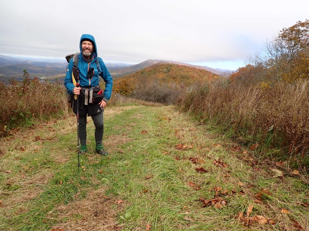
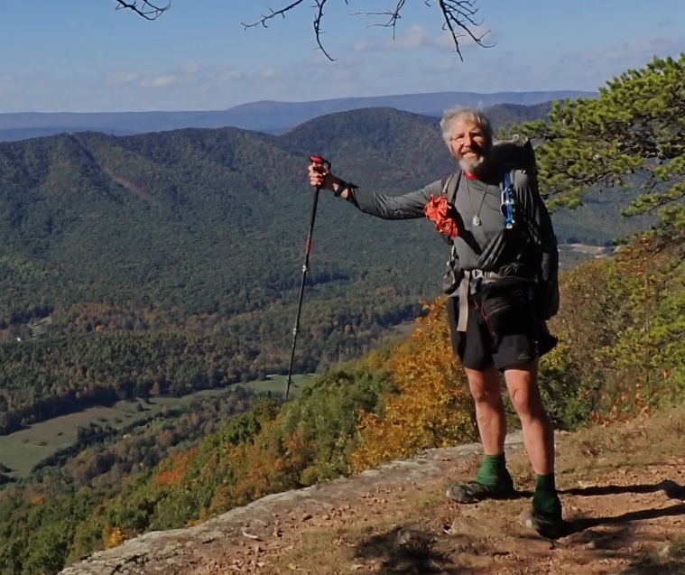
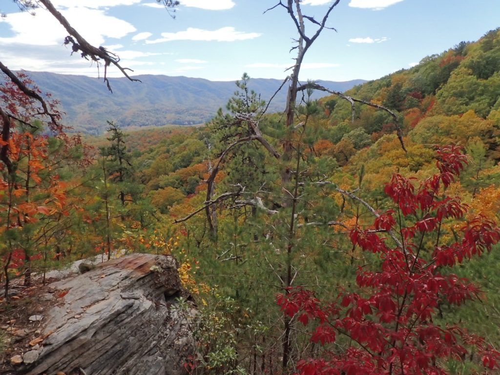
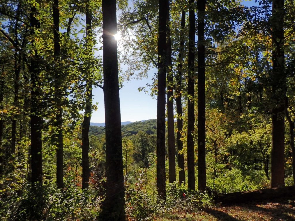
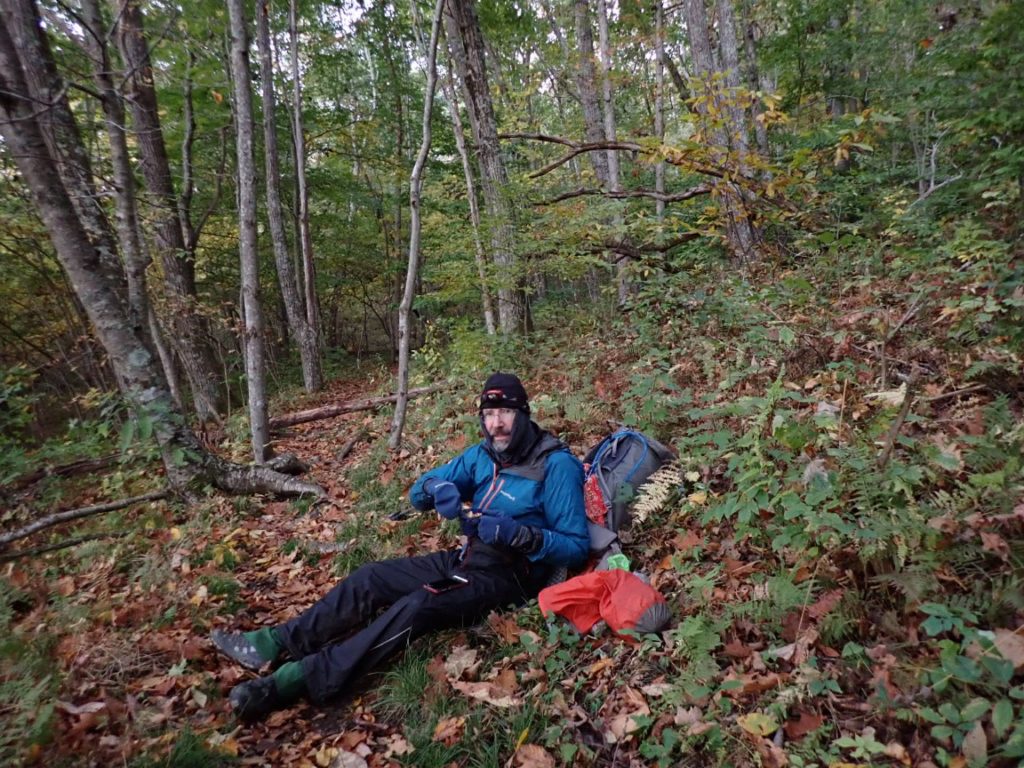
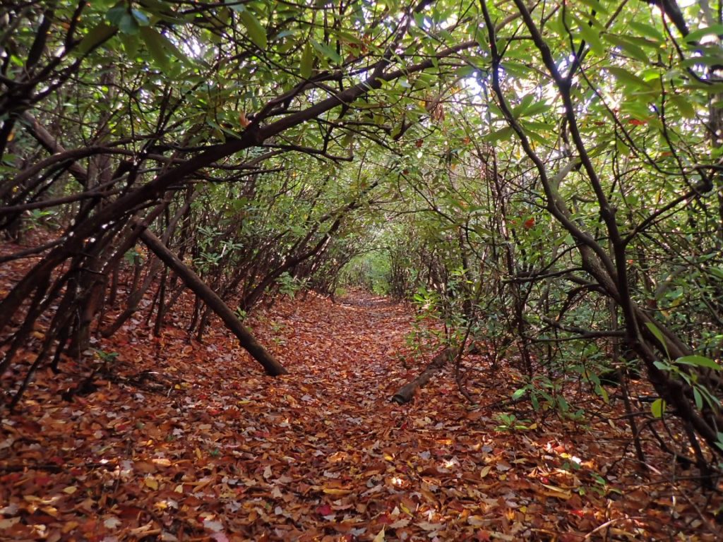
Taking a day off the trail at Woods Hole Hostel was on my mind for a long time. The hostel is just 0.4 mile from the AT along a gravel road high up at 3,355′. It has a very positive reputation as a quiet, peaceful rest stop. Neville, the owner, grows organic vegetables, raises goats and heats with wood. The heat is important because it is chilly! The hike to Woods Hole started in light rain which stopped during the 2,000 foot ascent up the ridge from town. The trail was covered in colorful leaves and rhododendrons sometimes formed a green tunnel with their long, green leaves.

A rhododendron green tunnel.

See my real-time location produced by the InReach unit I carry and a daily log of my progress on the trail.

Continue reading “Days 129-130, October 29-30: Woods Hole and another zero day”

Days 127-128, October 27-28: A 24 mile hike and a zero day!

Pearisburg was my next resupply opportunity and I had cold weather gear waiting for pickup at the post office. My plan was to arrive there on October 28. On the trail very early again my progress was good and the weather was fine. If I reached the Rice Shelter by 4pm it would be feasible to hike 8 more miles to a hotel in town. From the high ridge at 3350′ I began a pleasant descent as the sun sank lower toward the western horizon. By 6pm I retrieve the headlamp from my backpack and switched on the bright beam to light up the trail and Main Street to the Plaza Motel.

The chilly wind did not slow my progress into Pearisburg.
Continue reading “Days 127-128, October 27-28: A 24 mile hike and a zero day!”

Days 122-124, October 22-24: The Virginia Triple Crown

After hiking into Daleville on October 22 to resupply I returned to the trail the next day with clear sky and a sometimes strong, chilly wind. The temperature changed often depending on how much chill the wind delivered to the AT, which made a circuitous route above a wide, deep valley. One side of the ridgetops had views of the Daleville area, the side of the nice valley. The trail climbed to one of the iconic features of this part of Virginia, Tinker Cliffs.

On the edge of Tinker Cliffs.
Continue reading “Days 122-124, October 22-24: The Virginia Triple Crown”

Day 126, October 26: It’s cold out here and I have a plan!

Day 126, 26-Oct. Milepost: 1532.5 miles,  Daily: 21.2, Ascent: 4895′, Descent: 4870′, Highest: 4125′. Camp: Bailey Gap Shelter. Jefferson National Forest, 3515′.

Departed camp at 5:30am by headlamp with plan to hike 21 miles to Bailey Gap Shelter. Chilly wind blew strong as I ascended two ridges, the second at 4100′. Hiked through two wilderness areas and a tedius 5-mile, rocky segment.  Temperature fell to 40 degrees in late afternoon.  Arrived at Bailey Gap Shelter in 12 hours 15 minutes. COLD!

Sunrise after I descended the ridge from camp.
Continue reading “Day 126, October 26: It’s cold out here and I have a plan!”

Day 125, October 25: Sun and rain

The day started nicely as I hiked up the next ridge to 3,000 feet from the campsite at 1,850′. The eyes of a not-so-shy deer reflected back toward me as my headlamp aimed in its direction. The top of the first ridge was level and mellow for several miles before descending to a valley. With a goal to hike 16 miles to the Sarver Hollow Shelter I climbed to the top of a 3,400′ ridge with some urgency because rain was forecast to begin at 3 or 4 pm. I enjoyed some fall colors as I hurried along the trail which had occasional nasty rock slabs reminiscent of New Hampshire. Rain began to fall shortly after 3pm, but the heavy rain started just as I reached the shelter, which provided an escape from the storm for the night. Tomorrow the weather is expected to be very nice!

Continue reading “Day 125, October 25: Sun and rain”

Day 121, October 21: Looking at the Peaks of Otter.

The highlight of my 18.7 miles along the AT was seeing the Peaks of Otter. My previous visit to these mountains was 1961! As a kid attending second grade my family lived in nearby Lynchburg, Virginia for just one year. Having been born in Chicago and lived the first seven years of my life in only the flat Midwest, living near such mountains was a special time. I discovered the wildness of nature in the creek and meadows near our home. A look out our living room window revealed the Blue Ridge Mountains. I knew nothing about the Appalachian Trail, but it certainly was there in 1961. One day we all got into our 1957 Plymouth and drove to an overlook with a view of the Peaks of Otter. I doubt it was the same spot as shown in these photos. Regardless, returning to these mountains as a thru-hiker rekindled many memories of Lynchburg and the beginning of a personal journey of the mountains and the natural world.

Along the Blue Ridge Parkway is a parking area with a view of the Peaks of Otter.

Day 121, 21-Oct. Milepost: 1451.6 miles, Daily: 18.7, Ascent: 3775′, Descent: 3850′, Highest: 2705′. Camp: Wilson Creek Shelter, Jefferson Natl Forest, 1855′. Sunny weather until rain shower at 6pm. I was fatigued despite the well graded trail.

Some historical perspective of the Peaks of Otter.
Another expansive view on October 21.

Day 120, October 20: The Guillotine and 10,315 feet of elevation change

Day 120, 20-Oct.  Milepost: 1432.9 milrd, Daily: 19.4. Ascent: 4985′, Descent: 5330′, Highest: 4250′. Camp: Ridgetop between North and Middle Creeks, Jefferson National Forest, 2025′.  Cool weather and awesome hike over Apple Orchard Mtn (4,200′) and other ridgetops. Walked through deep layers of crisp, dry leaves on the trail.  Camped alone on nice ridgetop.  65.3% completed, 760 miles to Springer Mountain!

The Guillotine Rock on the AT
Continue reading “Day 120, October 20: The Guillotine and 10,315 feet of elevation change”

Days 118-119, October 18-19: Enjoying the Shenandoah and Virginia

Day 118, 18-Oct. Milepost: 1405.8 miles, Daily: 15.0, Ascent: 3820′, Descent: 4110′  Highest: 3350′.  Town: Glasgow (Stanimal’s 328 Hostel).  Great views from ridgetops on a chilly, windy morning. Warmed nicely for descent to James River.  Joined three section hikers for Mexican dinner in Buena Vista.  Nice, relaxing place to begin planning for colder weather into November and early December.

Day 119, 19-Oct. Milepost: 1413.5 miles, Daily: 7.7. Ascent: 2325′, Descent: 580′, Highest: 2610′.  Camp: Marble Spring, James River Face Wilderness,  2350′.  Excellent warm weather for climb above James River to a stealth camp in James River Face Wilderness. Short day on the trail after resupplying in Glasgow.

Continue reading “Days 118-119, October 18-19: Enjoying the Shenandoah and Virginia”

Day 117, October 17: 21 miles in the Shenandoah

Day 117, 17-Oct. Milepost: 1390.8 miles, Daily: 20.9. 64.1% completed!  Ascent: 2810′, Descent: 5685′, Highest: 4050′.  Camp: Lynchburg Reservoir Rd area, Blue Ridge Mtns, 1000′. 40 degrees in early morning! Great hiking weather with great sunny views from Cole Mtn. Long descent to 1000′ out of the wind.  Met the Sutton family who thru-hiked the AT this year with their 5-year old boy.

Cold morning!
Continue reading “Day 117, October 17: 21 miles in the Shenandoah”

Day 116, October 16: Shenandoah Sunrise

Day 116, 16-Oct.  Milepost: 1369.9 miles,  Daily: 17.4, Ascent: 5010′, Descent: 5210′, Highest: 4080′. Camp: Seeley-Woodworth Shelter, Washington National Forest, 3770′. Awesome sunrise while descending Three Ridges, followed by 3000′ ascent to The Priest ridge. 25 mph wind gusts and much cooler temperature. 62.5% of AT miles hiked.

It was the most scenic sunrise I have witnessed on the AT hike so far. Starting the days hike before sunrise gives me opportunities to watch the sun rise if I have a view through trees or on overlooks. The weather has been clear and cold in the mornings lately.

I enjoyed feeling the cool breeze while during a warm afternoon climb. But soon after this the rain and wind happened!