
69 miles! That is all that remains of the Appalachian Trail for me to hike between today, December 8, and December 15, the day Cindy will meet me at Springer Mountain. There were signs that the end of my journey was near. I crossed the place on the AT that was just 100 miles from Springer Mountain. Soon after that was the border between North Carolina and Georgia, the final state to enjoy.
I could hike the remaining 69 miles in five easy days, but December 15 is 7 days ahead. With rainy weather forecast for December 10 and 11, I will hike on 9th and return to the Hostel Around the Bend in Hiawassee, Georgia for the two rainy days. On the 12th, after the rain clears, I will return to the AT and hike to Springer Mountain in four days which are forecasted to be sunny and warmer! Having the strong likelihood of nice weather for the final days of this thru-hike is a relief and an affirmation the good weather karma bestowed upon me. I have hiked the AT well…staying within my zone, accepting the solitude, enjoying the camaraderie of the hikers I meet, inhaling the experience of thru-hiking the AT. Staying healthy and injury free is one of the most gratifying part of the experience.
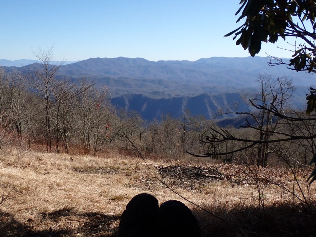
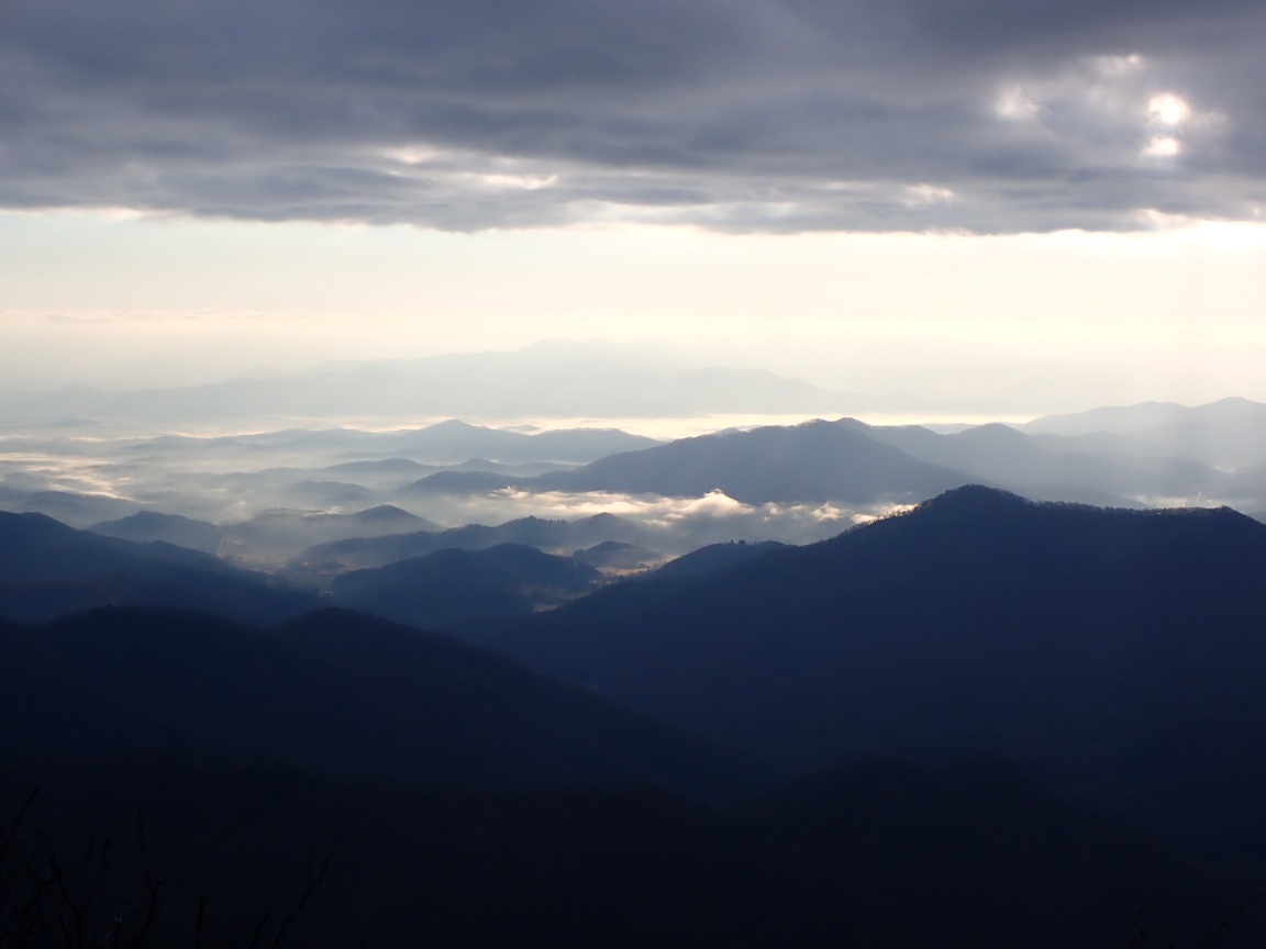
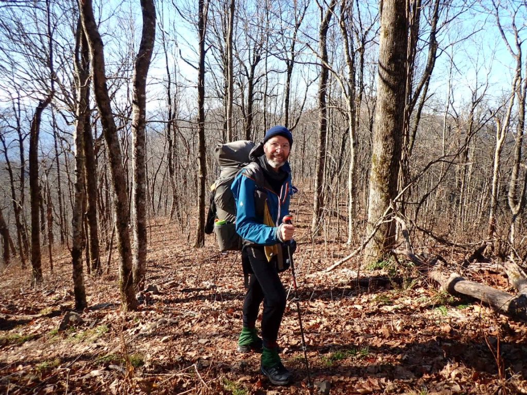
Day 164, 3-Dec. Milepost: 2056.4, Daily: 13.9, Ascent: 3155′, Descent: 4525′, Highest: 5060′. Destination: Nantahala Outdoor Center (Creekside Paradise B&B). Sunny, 70 degrees. Ascended to Cheoah Bald, 5052′ with nice view to south across Nantahala Gorge.
Day 165, 4-Dec. Milepost: 2067.9, Daily: 11.5, Ascent: 4590′, Descent: 1470′, Highest: 5155′. Camp: Cold Spring Shelter, Nantahala NF, 4920′. Up, up, up from Nantahala River Gorge and NOC. Very steep sometimes making me sweat, a nice contrast from the frigid, cold days in the Smokies!. Sunny, 62 degrees.
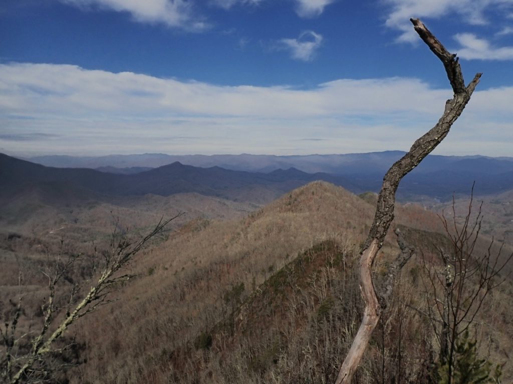
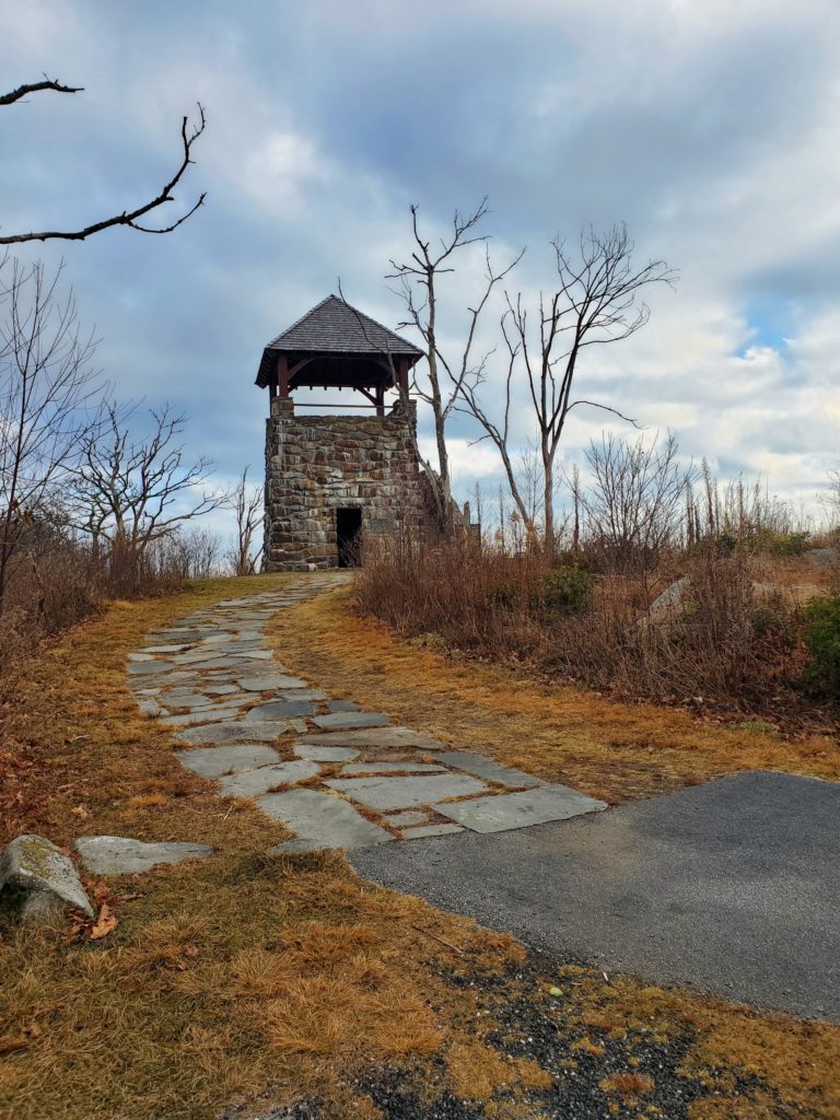
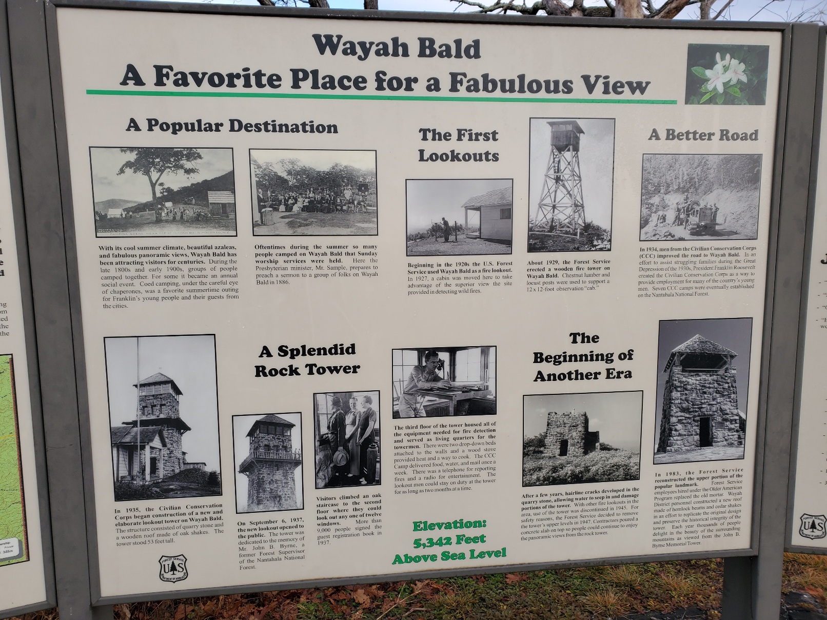
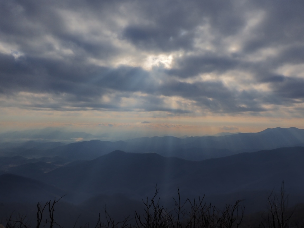
Day 166, 5-Dec. Milepost: 2087.5, Daily: 19.6, Ascent: 3670′, Descent: 4845′, Highest: 5340′. Camp: Rock Gap Shelter, Nantahala NF, 3796′. Magical view of mountains, clouds and sunlight from Wayah Bald, 5,338′. Mild weather turned to clouds and a few showers. Felt slow and sluggish because of previous day arduous climb from NOC. 106 MILES REMAINING!
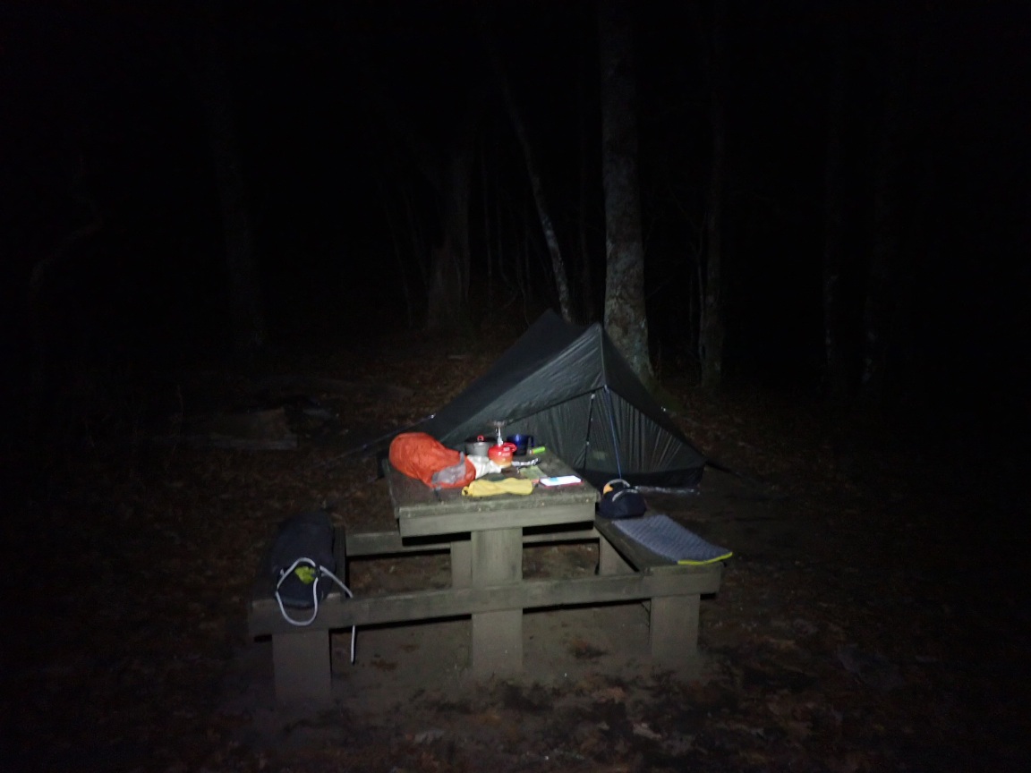
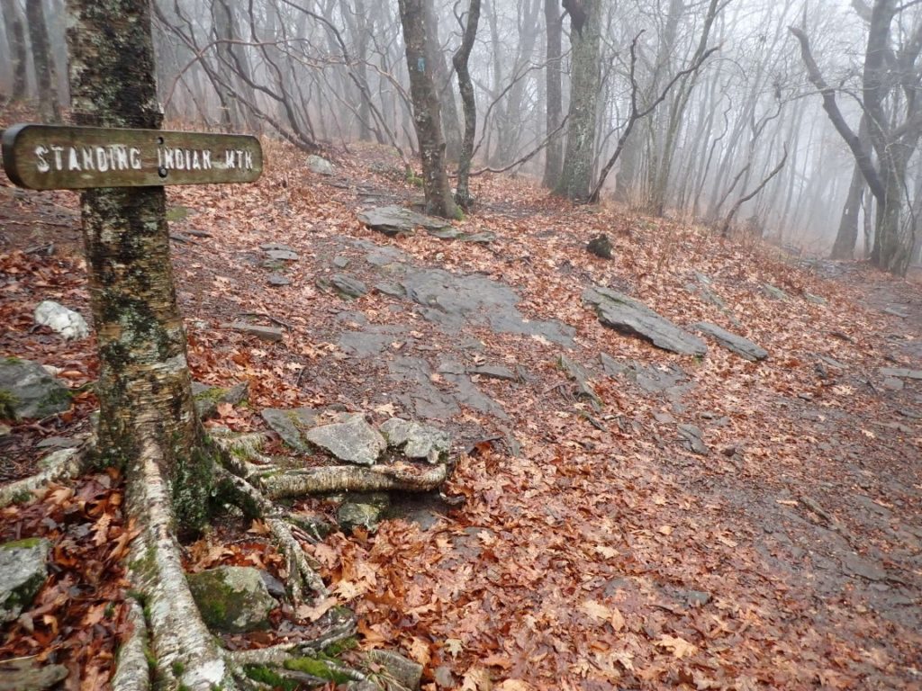
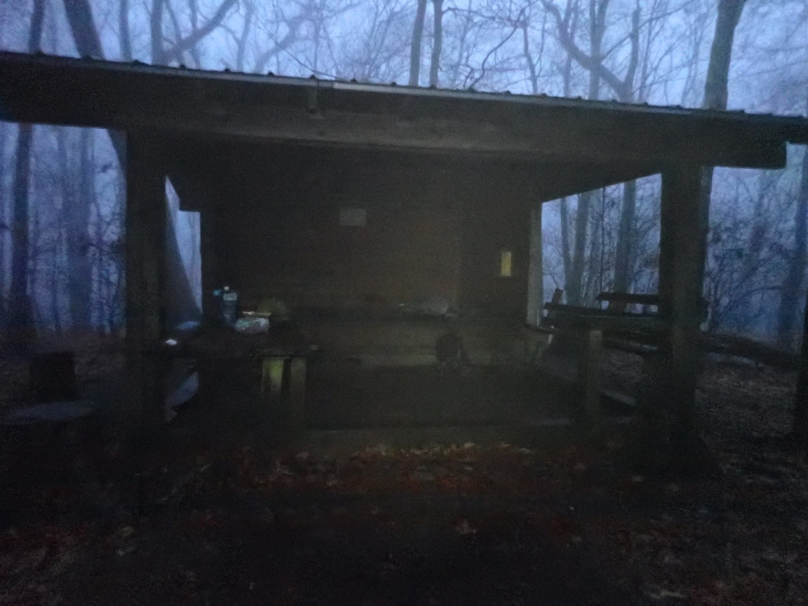
Day 167, 6-Dec. Milepost: 2107.2, Daily: 19.7, Ascent: 3960′, Descent: 3020′ Highest: 5385′. Camp: Standing Indian Shelter, 4751′. Rain showers after 10am, temp chilly 50 degrees. Nice hiking otherwise. Will sleep in shelter to stay drier.
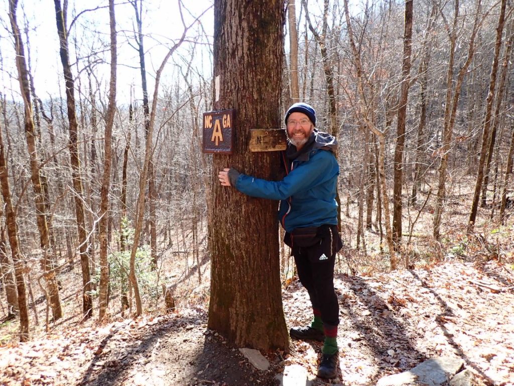
Day 168, 7-Dec. Milepost: 2123.9, Daily: 16.7, Ascent: 3240′, Descent: 5290′, Highest: 4835′. Camp: Dick’s Creek Gap (Hostel Around the Bend), 2513′. Mild, dry weather after a damp, windy night. Reached GEORGIA!! Feeling optimistic about a great finish on December 15. 69 MILES REMAINING!
And…Greg in Wild hikes on!
mouse found a candy wrapper? Was the candy gone? Tragedy…
Wow! It just seemed like yesterday you were in NH/Vermont. Stay warm, stay safe. Springer will be a joyful reunion and celebration! Savor every step to the finish. I have never feared bears, but those damn mice….
Brownie
You are very close to the end of this journey. A job well done. Thank you for all the information you have shared Along with beautiful pictures . You did it Roger . Your way♀️❤️
Congrats on a smooth finish. Looking forward to the last few posts. You are hiking my neck of the AT now. Enjoy. Its beautiful and its home. Hike on….NOT to Hartsfield…hahaha.
Count down to the end! There’s a whole group ( even if they don’t comment) that are following you. Stay safe
A true tree-hugger! Well done, Roger-Greg!!!!!
Shoot, you’ve come so far and so long that you could hike all the way to Atlanta Hartsfield Airport if you wanted to!
No!